


Livadia - Kato Asites
Livadia - Kato Asites
E4 Trail


things must take with you


GRADE difficult
ABOUT
The Livadia-Ano Asites route, spanning 45 kilometres, offers a challenging two-day journey tailored for experienced climbers.
On the first day, departing from Livadia, we commence the ascent on an uphill asphalt road that leads us to Lakkos Mygerou at an elevation of 1,600 metres. The route is challenging and steep, and after approximately 3 hours of hiking, we arrive at Lakkos Mygerou, where the refuge is situated. The Cultural Association of Livadia is responsible for the operation of the refuge.
Within the shelter, there are six beds, access to water, toilet facilities, and fireplaces. The small plateau of Mygeros remains snow-covered for an extended period during the winter season. In recent years, this location has hosted various events, including mountaineering races, ski mountaineering lessons, and other introductory activities related to various mountain sports.
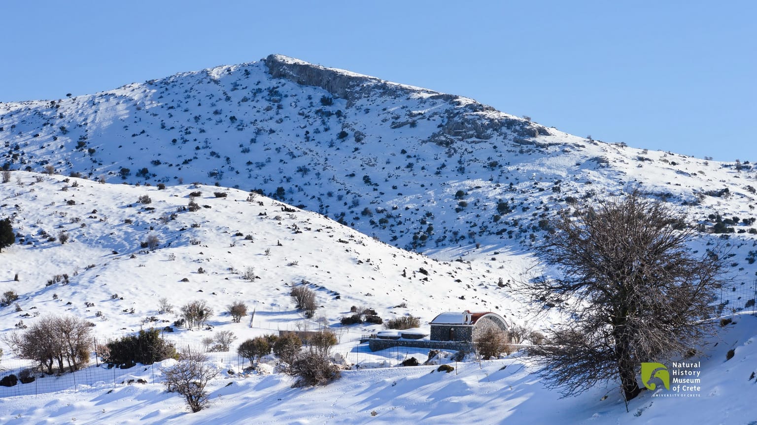
From this point, the 6.5-kilometre trail to the summit of Timios Stavros (Holy Cross) begins. In the middle of the route, it intersects with the E4 path, which originates from Nida and leads to the chapel at an altitude of 2,456 metres. The chapel itself was constructed using the same traditional technique that the shepherds of Psiloritis have employed for centuries, using simple mountain stones without any binding material. The panoramic view from the island's summit is unparalleled in all directions of the horizon, and for much of the year, it is blanketed in snow.
In recent years, on the north side of the mountain, specifically in the Livadiotiko Aori area, a remarkably beautiful and well-designed hiking trail known as ‘the Strata of Psiloritis’ has been created. This trail commences from the Lakkos Mygerou plateau at an altitude of 1,580 metres and offers the shortest route to ascend to the summit of Timios Stavros. The path is properly marked and a significant portion of it is paved with stone slabs, providing hikers with a delightful and enjoyable ascent experience.
During the winter season, the shelter is typically enveloped in snow. However, starting from spring and onwards, when the snow melts, it remains accessible to all visitors. There's even an option for accommodation. However, it's important to note that this shelter is designated as an emergency shelter, and as such, it does not provide food, water, or bedding. Visitors are responsible for ensuring they have made adequate provisions for these necessities. Additionally, please be aware that there is no mobile phone signal available at the site.
On the second day, the journey extends from Lakkos Mygerou to Kato Asites, spanning a distance of 23 kilometres. At this point, we follow a path that is not particularly well marked, so it's important to exercise caution. Continuing eastward for approximately 2 kilometres, we encounter some shepherd's huts known as ‘mitata’, which are often open during the summer when shepherds graze their sheep in the area. Ultimately, we arrive at the ski resort.
The concept of a ski resort in Anogia began to take shape in the early 1980s. However, it wasn't until the early 1990s that a substantial portion of the infrastructure was put in place. Initially, the road was opened, and a few ski lifts were installed. Recently, the road has been paved with asphalt.
The ski resort now serves as a grazing ground for dozens of animals, and there isn't a single square metre that hasn't been covered by a thick layer of manure. While the stone structures remain in relatively good condition, the concrete ones have suffered significant damage. Many of the windows and doors have been either broken or removed. Additionally, the ski slope that was once designed for enthusiasts has become overgrown with bushes and is barely distinguishable from the surrounding mountain terrain.
Following the ski resort, we continue along the road towards the observatory. The Skinakas Observatory is a collaborative research facility involving the Foundation for Research and Technology, the University of Crete, and the Max Planck Institute for Extra-terrestrial Physics of Germany.
The Skinakas Observatory, situated atop the peak of Skinakas on Psiloritis at an altitude of 1,750 metres, provides exceptional conditions for conducting high-quality astronomical observations in the Mediterranean region. The observatory boasts a wide array of instruments, making it one of the most well-equipped observatories globally, especially considering its size.
The observatory hosts free public visit days each year, during which visitors have the opportunity to gain a preliminary understanding of how the observatory operates, receive information about the latest advancements in astrophysics, and even engage in telescope observations. The specific dates for these public visits are announced annually on the observatory's website.
As we continue along the dirt road, we enter the Rouvas forest. The Rouvas forest is a significant ecosystem comprised of a holly (kermes oak tree) forest of national importance, occupying the interior valley of Psiloritis. Within this forest, you'll find ancient oak trees with trunks that, in some instances, exceed 1 metre in diameter and can reach heights of up to 15 metres.
Alternatively, from the forest, you can descend into the 4-kilometre-long Rouvas Gorge and eventually arrive at the village of Zaros, where overnight accommodation is available. Just before reaching Diplori, the trail ascends and leads to the saddle of the Giristi peak. By following the E4 trail markers, you'll reach the refuge of the mountaineering club of Heraklion in Asites.
The shelter has been in operation since 1967 and has a capacity to accommodate up to 30 people. To use the shelter, it's advisable to make prior arrangements with the club responsible for its operation, namely the Mountaineering Club of Heraklion (eos-her.gr). The shelter is heated using a stove and fireplace and includes a dining room and a fully equipped kitchen with gas and wood. Electricity is provided by a generator, water is supplied from a tank, and there are indoor toilet facilities within the shelter.
After travelling 2 kilometres through the gorge, you'll arrive at Ano Asites and then proceed to Kato Asites. In Kato Asites, you have the option to find accommodation.

see also


Search
for
— things to do, a place to go


Trends